Hello everyone,
to briefly explain the title: a construction road was built on our undeveloped plot to access neighboring properties. In the process, two boundary markers (wooden stakes with neon markings) were removed or buried. Two companies were present, but neither is admitting responsibility, and the matter is urgent.
We only noticed this today during an inspection of our property, and next week the earthworks are scheduled to start, including the laying of the sand layer.
Now I am desperately thinking about how to restore at least two boundary points. I actually have all the necessary data: the exact coordinates of each point, every angle, and every distance. But is it possible for me to locate even one point myself, with a tolerance of 10cm (4 inches)? (“It used to be done with just a tape measure.”) Or do I have to bite the bullet and spend around 800€ waiting for a surveying company to be available?

Rough staking out, if you feel confident and your earthworker has no objections, you can easily do it yourself. In any case, a larger area will need to be excavated around the perimeter – being off by a few centimeters (inches) doesn’t matter at this stage.
For precise staking out, especially when building close to property boundaries, I would definitely have a surveyor handle it.
For precise staking out, especially when building close to property boundaries, I would definitely have a surveyor handle it.
I (trained as a surveyor) marked out the rough layout of our house myself, using a measuring tape, marking paint, and a batten arc. I must admit, it’s not on the property boundary, but it’s completely sufficient for excavation.
Look up what a BATTEN ARC means or post a sketch. It should show the boundary lengths to the now missing points.
Look up what a BATTEN ARC means or post a sketch. It should show the boundary lengths to the now missing points.
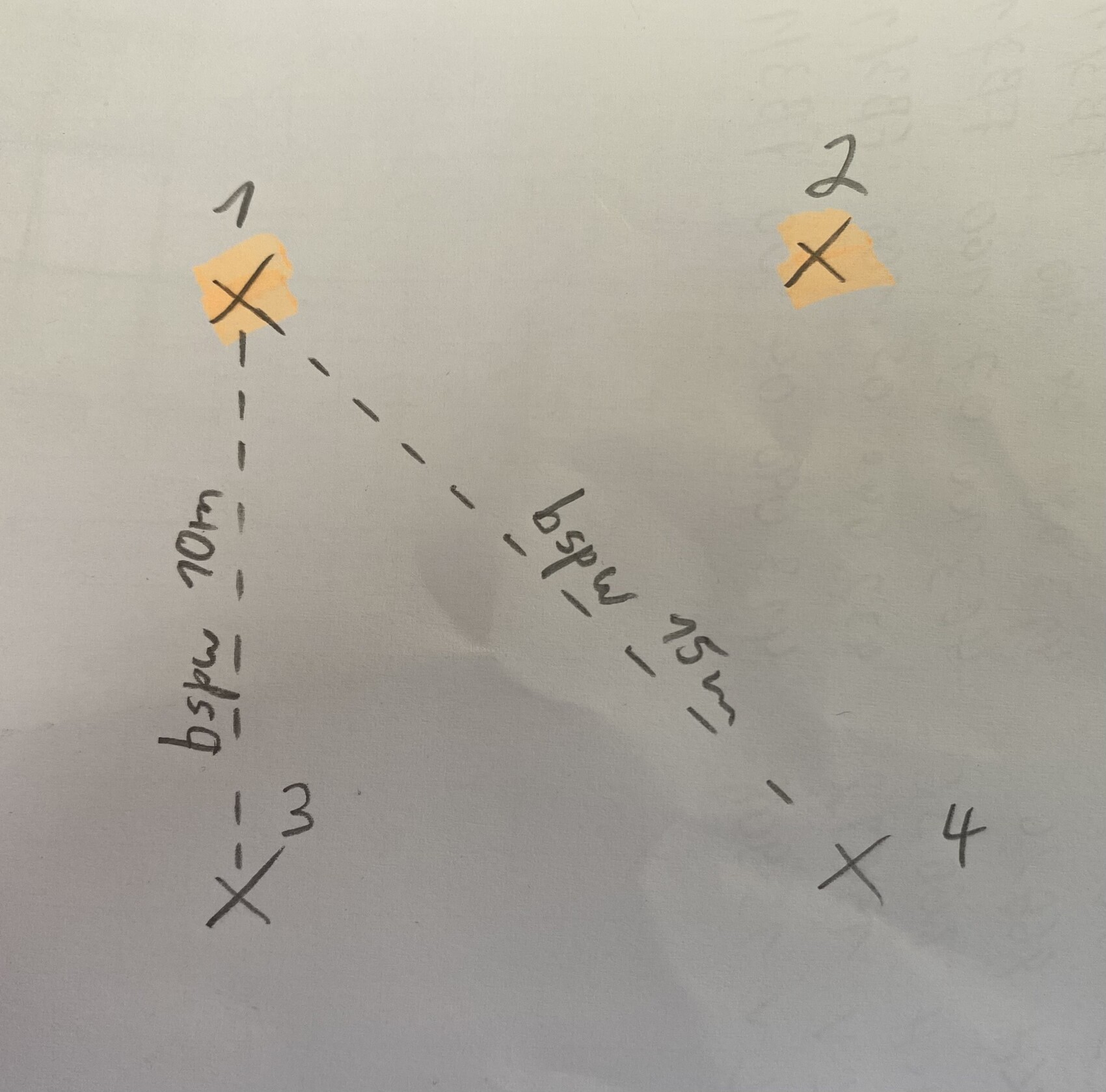
Points 1 and 2 are gone.
From point 3, use a measuring tape to draw an arc with a radius of 10m (33 feet) where point 1 could approximately be located. Do the same from point 4 with a radius of 15m (49 feet).
Where both arcs intersect and form a cross is your point 1. Repeat the same process similarly to determine point 2.
I will skip details on how this could be done even more precisely.
Similar topics