Hello everyone,
We have found a nice, vacant plot in a new development area on the edge of a forest that we could potentially purchase. However, we are still concerned about the slope. To us, it looks like a gentle slope. The plot still needs to be surveyed.
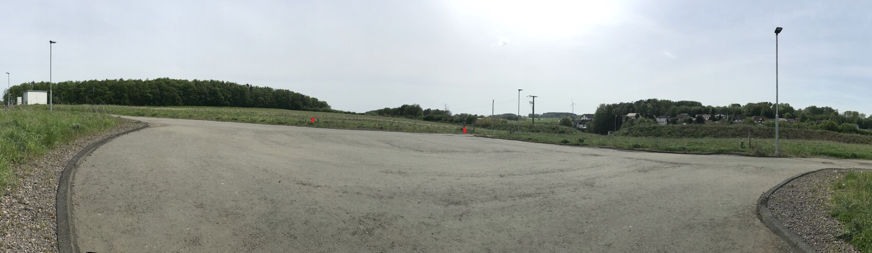
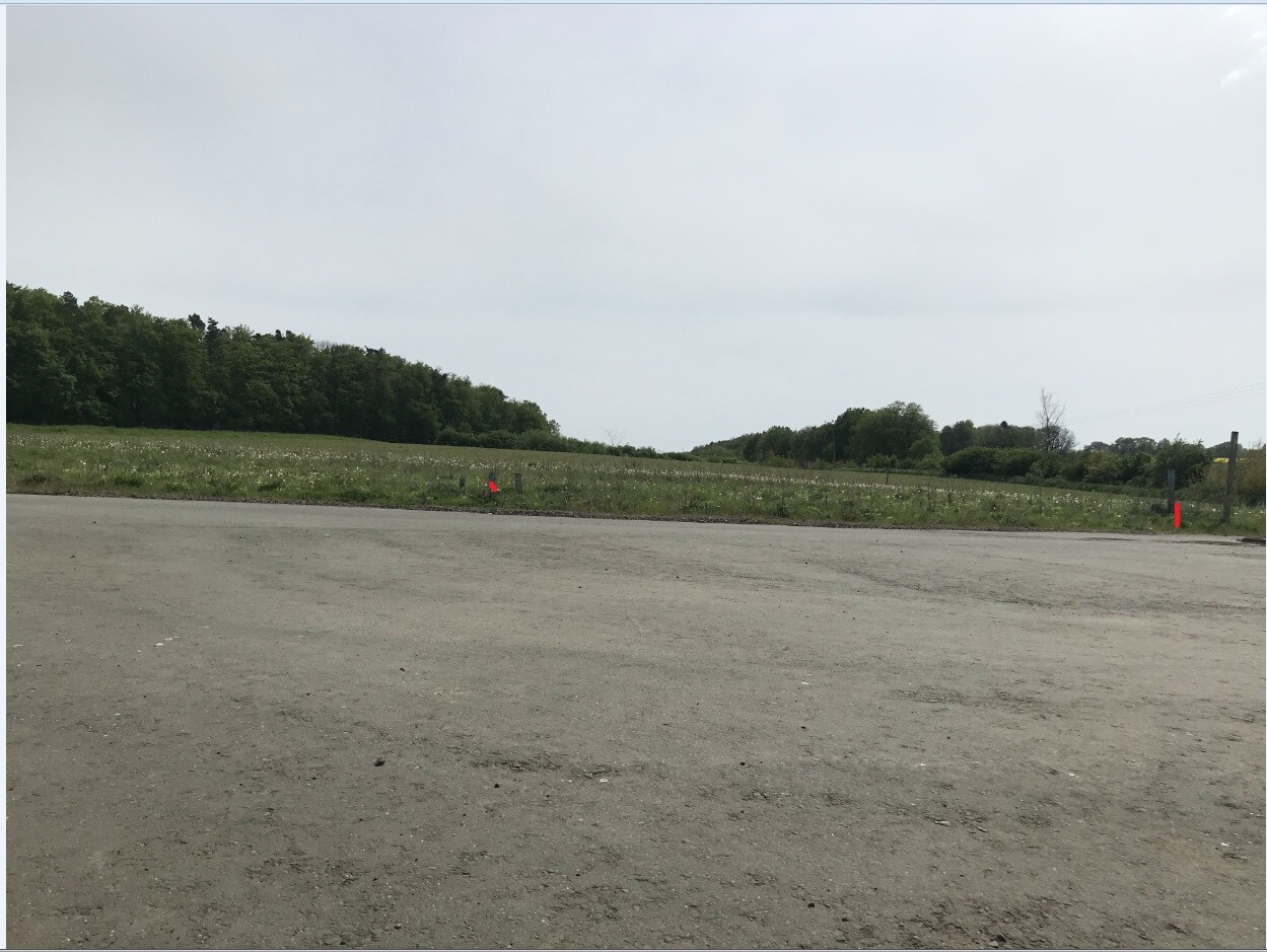
What do you think when you see the photos of the property? Would you already consider this a steep slope? Should we expect significant additional construction costs, for example for the foundation or possibly some leveling with retaining blocks?
As experts, would you buy the plot with this slope or look for a flat plot instead?
The photos of the property are attached.
Thanks in advance for your replies.
Best regards
We have found a nice, vacant plot in a new development area on the edge of a forest that we could potentially purchase. However, we are still concerned about the slope. To us, it looks like a gentle slope. The plot still needs to be surveyed.
What do you think when you see the photos of the property? Would you already consider this a steep slope? Should we expect significant additional construction costs, for example for the foundation or possibly some leveling with retaining blocks?
As experts, would you buy the plot with this slope or look for a flat plot instead?
The photos of the property are attached.
Thanks in advance for your replies.
Best regards
 Papierturm5 Aug 2024 20:44
I prefer not to make guesses based on photos, since my own photos tend to be taken at awkward angles. However, here’s a suggestion:
The Geoportal NRW offers the option to measure elevation profiles. I also found the same feature in the Geoportal Hessen under the topographic maps. Maybe the data there is quite accurate, providing a rough idea?
On our property, which we recently had surveyed (NRW), the elevation profiles and heights were very close—only a few centimeters off. That already gives actual numbers that experts (which I am not) can surely make use of.
PS: A property involves more than just slope or no slope. The perfect 100% solution is rare. Location, ground conditions, surroundings, accessibility, and countless other factors also play a role, along with things like building permits/planning permission and other regulations.

Basically, the geoportal is always a useful tool to find information about your plot of land. However, in new development areas, the question always arises whether the data is up to date. It is not uncommon for the area to have been recently developed, with the terrain remodeled in the process. How long has the new development area been around?
With photos, it is easy to be misled. Visually, I don’t find it steep enough for it to be an unaffordable project.
With photos, it is easy to be misled. Visually, I don’t find it steep enough for it to be an unaffordable project.
H
hanghaus20236 Aug 2024 16:52Based on the photos, it doesn’t look very steep. Try placing a straight edge along the property boundaries and use your phone to measure the slope. This method gives a more accurate indication than a photo. Is there no zoning plan with height restrictions?
The reference to the geoportal is very helpful.
The reference to the geoportal is very helpful.
Thank you very much for the tips.
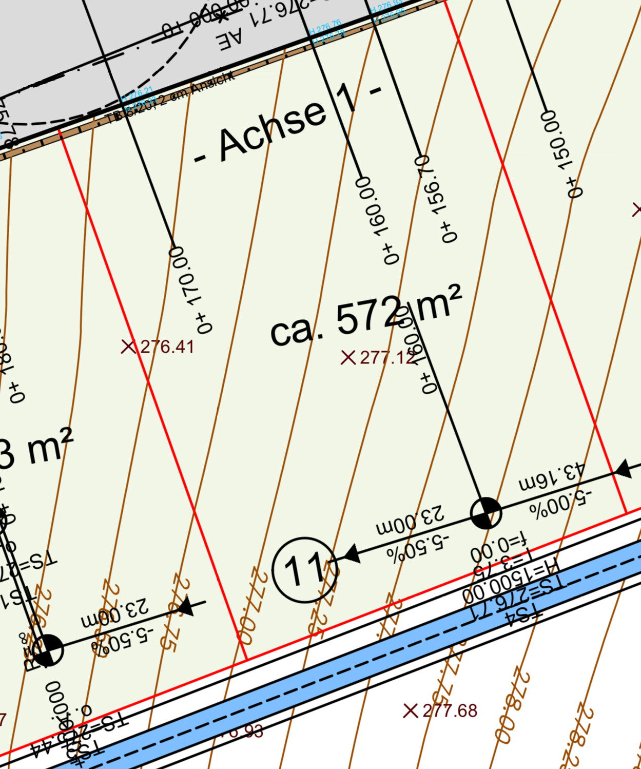
I have now finally found what I was looking for.
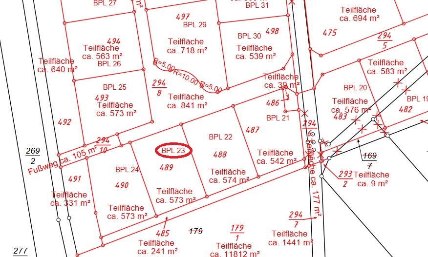
I have attached a section of the contour lines. I’m not entirely sure, but it seems steeper than it looks.
Am I correct in seeing that there is about a 2-meter (6.5 feet) slope indicated there?
Is that a lot or still within a "normal range"?
Thank you in advance for your answers.
Best regards
I have now finally found what I was looking for.
I have attached a section of the contour lines. I’m not entirely sure, but it seems steeper than it looks.
Am I correct in seeing that there is about a 2-meter (6.5 feet) slope indicated there?
Is that a lot or still within a "normal range"?
Thank you in advance for your answers.
Best regards
Similar topics