Hello everyone,
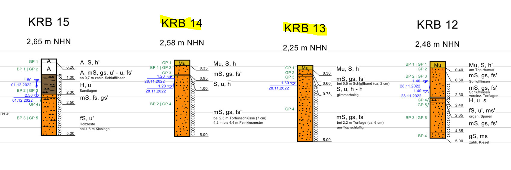
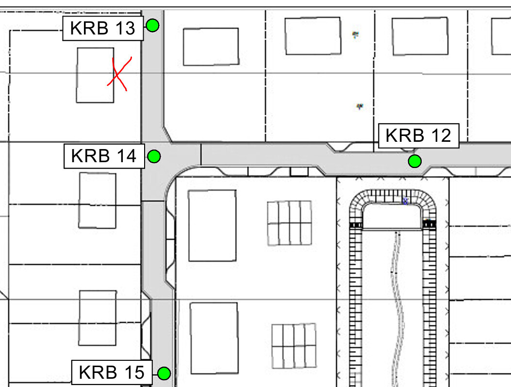
we are planning to purchase a plot of land and have received a geotechnical survey from the local authority. I have attached a screenshot with the results. Measurements 13 and 14 were taken directly next to the property, while the other two are about 50 meters (165 feet) from the property boundary. The plot is marked with an X.
We are now wondering what impact this might have on the foundation and costs.
Does anyone have experience with similar soil conditions? Should we expect additional costs for soil replacement or special foundation measures?
Thanks for your insights!
M
MachsSelbst17 Mar 2025 14:44It would also be interesting to know when the drilling took place.
We had soil surveys in August and October, each showing groundwater levels at 1.5 meters (5 feet) and 1 meter (3 feet) below finished ground level, respectively... and in December the year before last, when northern Germany was completely flooded, the groundwater even reached the concrete slab at our site.
Looking at the photo with the large puddle... unless there was heavy rain two days ago... the new development area here looked quite similar, with poor infiltration. Retention basins are generally built where there are problems with rainwater infiltration.
If in doubt, ask local residents about how the area has behaved over the years, especially after periods of heavy rain in a short time.
N
NeubauWinsen17 Mar 2025 21:53Thank you very much for the numerous responses. We will commission a soil investigation. Then we will see where we stand. It will probably take a few weeks until the results are available.